
Estimativa da altura da base das copas com o uso de dados laser scanning aerotransportado (LiDAR)
DOI:
https://doi.org/10.20873/jbb.uft.cemaf.v3n3.giongoPalavras-chave:
LIDAR, inventário florestal de precisão, incêndio florestalResumo
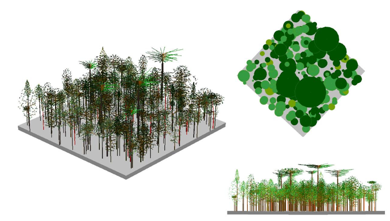
Ultimamente, a aquisição de dados usando o Airborne Laser Scanning (ALS) com a tecnologia LiDAR (Light Detection and Ranging) está se tornando promissora no campo florestal, especialmente para estimativa de variáveis dendrométricas e para avaliar a estrutura vertical e horizontal da floresta. As informações topográficas e de cobertura florestal são extremamente importantes para os gerentes de florestas e recursos naturais. Informações precisas sobre a altura e densidade das árvores são fundamentais para o planejamento, mas também são difíceis de obter pelos métodos convencionais. O uso da modelagem associada aos dados do LIDAR permite ao pesquisador obter estimativas de várias outras variáveis florestais, como área basal, diâmetro, volume, biomassa e material combustível. A estimativa das alturas base das árvores com parcelas de diferentes tamanhos (10, 15 e 20 metros) mostrou um erro padrão de 1,42, 0,95 e 0,82 m, o que corresponde a 23,62, 15,70 e 13,84%, respectivamente.
Referências
Andersen, H.-E.; McGaughey, R.; Reutebuch, S.; Schreuder, G.; Agee, J.; Mercer, B. (2004), Estimating canopy fuel parameters in a pacific northwest conifer forest using multifrequency polarimetric IFSAR. Paper presented at the International Archives of Photogrammetry and Remote Sensing, Istanbul, Turkey.
Andersen, H.-E.; McGaughey, R. J.; Reutebuch, S. E. (2005), Estimating forest canopy fuel parameters using LIDAR data Remote Sensing of Environment, 94 (4, 28), 441-449.
Andrews, P. L. (2009), BehavePlus fire modeling system, version 5.0: Variables: Department of Agriculture, Forest Service, Rocky Mountain Research Station.
Finney, M. A. (1998), FARSITE: Fire Area Simulator-model development and evaluation. Ogden, UT: U.S. Department of Agriculture, Forest Service, Rocky Mountain Research Station.
McAlpine, R. S. and Hobbs, M. W. (1994), Predicting the height to live crown base in plantation of four boreal forest species. Journal of International Wildlife, 103-106.
Mitsopoulos, I. D. and Dimitrakopoulos, A. P. (2007), Canopy fuel characteristics and potential crown fire behavior in Aleppo pine (Pinus halepensis Mill.) Annals of Forest Science, 64, 287-299.
Morsdorf, F.; Meiera, E.; Kotza, B.; Ittena, K. I.; Dobbertinc, M.; Allgowerb, B. (2004), LIDAR- based geometric reconstruction of boreal type forest stands at single tree level for forest and wildland fire management. Remote Sensing of Environment, 92, 353-362.
Næsset, E., and Økland, T. (2002), Estimating tree height and tree crown properties using airborne scanning laser in a boreal nature reserve. Remote Sensing of Environment, 79, 105-115.
Peel, M. C.; Finlayson, B. L.; McMahon, T. A. (2007), Updated world map of the Köppen-Geiger climate classification. Hydrology and Earth System Sciences - HESSD, 11, 1633-1644.
Riaño, D.; Meier, E.; Allgöwer, B.; Chuvieco, E.; Ustin, S. L. (2003). Modeling airborne laser scanning data for the spatial generation of critical forest parameters in fire behavior modeling. Remote Sensing of Environment, 86, 177-186.
Roff, A.; Goodwin, N.; Merton, R. (2005), Assessing Fuel Loads using Remote Sensing New South Wales Rural Fire Service Technical Report (pp. 11). Sydney, Autralia: University of New South Wales.
Scott, J. H., and Reinhardt, E. D. (2001), Assessing crown fire potential by linking models of surface and crown fire behavior (Vol. RMRS- RP-29, pp. 59). Fort Collins, CO: U.S. Department of Agriculture, Forest Service, Rocky Mountain Research Station.
Van Wagner, C. E. (1993), Prediction of crown fire behavior in two stands of jack pine. Canadian Journal of Research, 23, 442-449.
Zimble, D. A.; Evans, D. L.; Carlson, G. C.; Parker, R. C.; Grado, S. C.; Gerard, P. D. (2003), Characterizing vertical forest structure using small-footprint airborne LiDAR. Remote Sensing of Environment, 87, 171-182.
Publicado
Como Citar
Edição
Seção
Licença
Copyright (c) 2024 - Journal of Biotechnology and Biodiversity

Este obra está licenciado com uma Licença Creative Commons Atribuição 4.0 Internacional.
Autores que publicam nesta revista concordam com os seguintes termos:
Autores mantêm os direitos autorais e concedem à revista o direito de primeira publicação, com o trabalho simultaneamente licenciado sob a Licença Creative Commons Attribution (CC BY 4.0 no link http://creativecommons.org/licenses/by/4.0/) que permite o compartilhamento do trabalho com reconhecimento da autoria e publicação inicial nesta revista.
Autores têm autorização para assumir contratos adicionais separadamente, para distribuição não exclusiva da versão do trabalho publicada nesta revista (ex.: publicar em repositório institucional ou como capítulo de livro), com reconhecimento de autoria e publicação inicial nesta revista.
Autores têm permissão e são estimulados a publicar e distribuir seu trabalho online (ex.: em repositórios institucionais ou na sua página pessoal) a qualquer momento antes ou durante o processo editorial, já que isso pode gerar alterações produtivas, bem como aumentar o impacto e a citação do trabalho publicado (disponibilizado em O Efeito do Acesso Livre no link http://opcit.eprints.org/oacitation-biblio.html).