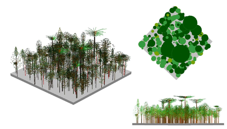
Canopy base height estimation using airborne laser scanning (LiDAR) data
DOI:
https://doi.org/10.20873/jbb.uft.cemaf.v3n3.giongoKeywords:
LIDAR, precision forest inventory, forest fireAbstract
Lately, data acquisition using Airborne Laser Scanning (ALS) with LiDAR technology (Light Detection and Ranging) is becoming promising in the forest field, especially for estimation of dendrometric variables and to evaluate vertical and horizontal structure of the forest. Topographic and forest coverage information are extremely important to forest and natural resources managers. Accurate information on trees height and density are fundamental for planning, but also hard to obtain by conventional methods. The use of modeling associated with LIDAR data allows the researcher to obtain estimates of several other forest variables, such as basal area, diameter, volume, biomass and combustible material. The estimation of the trees base heights with plots of different sizes (10, 15 and 20 meters) showed an standard error of 1.42, 0.95 and 0.82 m, which correspond to 23.62, 15.70 and 13.84%, respectively.
References
Andersen, H.-E.; McGaughey, R.; Reutebuch, S.; Schreuder, G.; Agee, J.; Mercer, B. (2004), Estimating canopy fuel parameters in a pacific northwest conifer forest using multifrequency polarimetric IFSAR. Paper presented at the International Archives of Photogrammetry and Remote Sensing, Istanbul, Turkey.
Andersen, H.-E.; McGaughey, R. J.; Reutebuch, S. E. (2005), Estimating forest canopy fuel parameters using LIDAR data Remote Sensing of Environment, 94 (4, 28), 441-449.
Andrews, P. L. (2009), BehavePlus fire modeling system, version 5.0: Variables: Department of Agriculture, Forest Service, Rocky Mountain Research Station.
Finney, M. A. (1998), FARSITE: Fire Area Simulator-model development and evaluation. Ogden, UT: U.S. Department of Agriculture, Forest Service, Rocky Mountain Research Station.
McAlpine, R. S. and Hobbs, M. W. (1994), Predicting the height to live crown base in plantation of four boreal forest species. Journal of International Wildlife, 103-106.
Mitsopoulos, I. D. and Dimitrakopoulos, A. P. (2007), Canopy fuel characteristics and potential crown fire behavior in Aleppo pine (Pinus halepensis Mill.) Annals of Forest Science, 64, 287-299.
Morsdorf, F.; Meiera, E.; Kotza, B.; Ittena, K. I.; Dobbertinc, M.; Allgowerb, B. (2004), LIDAR- based geometric reconstruction of boreal type forest stands at single tree level for forest and wildland fire management. Remote Sensing of Environment, 92, 353-362.
Næsset, E., and Økland, T. (2002), Estimating tree height and tree crown properties using airborne scanning laser in a boreal nature reserve. Remote Sensing of Environment, 79, 105-115.
Peel, M. C.; Finlayson, B. L.; McMahon, T. A. (2007), Updated world map of the Köppen-Geiger climate classification. Hydrology and Earth System Sciences - HESSD, 11, 1633-1644.
Riaño, D.; Meier, E.; Allgöwer, B.; Chuvieco, E.; Ustin, S. L. (2003). Modeling airborne laser scanning data for the spatial generation of critical forest parameters in fire behavior modeling. Remote Sensing of Environment, 86, 177-186.
Roff, A.; Goodwin, N.; Merton, R. (2005), Assessing Fuel Loads using Remote Sensing New South Wales Rural Fire Service Technical Report (pp. 11). Sydney, Autralia: University of New South Wales.
Scott, J. H., and Reinhardt, E. D. (2001), Assessing crown fire potential by linking models of surface and crown fire behavior (Vol. RMRS- RP-29, pp. 59). Fort Collins, CO: U.S. Department of Agriculture, Forest Service, Rocky Mountain Research Station.
Van Wagner, C. E. (1993), Prediction of crown fire behavior in two stands of jack pine. Canadian Journal of Research, 23, 442-449.
Zimble, D. A.; Evans, D. L.; Carlson, G. C.; Parker, R. C.; Grado, S. C.; Gerard, P. D. (2003), Characterizing vertical forest structure using small-footprint airborne LiDAR. Remote Sensing of Environment, 87, 171-182.

Published
How to Cite
Issue
Section
License
Copyright (c) 2024 - Journal of Biotechnology and Biodiversity

This work is licensed under a Creative Commons Attribution 4.0 International License.
Authors who publish with this journal agree to the following terms:
Authors retain copyright and grant the journal right of first publication with the work simultaneously licensed under a Creative Commons Attribution License (CC BY 4.0 at http://creativecommons.org/licenses/by/4.0/) that allows others to share the work with an acknowledgement of the work's authorship and initial publication in this journal.
Authors are able to enter into separate, additional contractual arrangements for the non-exclusive distribution of the journal's published version of the work (e.g., post it to an institutional repository or publish it in a book), with an acknowledgement of its initial publication in this journal.
Authors are permitted and encouraged to post their work online (e.g. in institutional repositories or on their website) prior to and during the submission process, as it can lead to productive exchanges, as well as earlier and greater citation of published work (Available at The Effect of Open Access, at http://opcit.eprints.org/oacitation-biblio.html).


